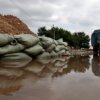
 Updated information on the Far Eastern Center for Hydrometeorology and Environmental Monitoring, at p. Cupid is expected to achieve maximum levels of water in the city of Khabarovsk, Komsomolsk-on-Amur, Nikolaevsk-on-Amur, Mykolayiv regions, Khabarovsk, Nanai, Amur, Komsomol, Ulchsky. Thus, according to the forecast water levels in the Amur can reach elevations: August 20-25 at Khabarovsk — 650-700 cm, August 22-27 at p Yelabuga — 650-700 cm, August 24-30 at No. Trinity — 480 -530 cm, 27-31 August at the Komsomolsk-on-Amur — 680-720 cm, August 28 to September 2 at para Nizhnetambovskoye — 800-850 cm, August 30 to September 3 at para Tsimmermanovka — 650-700 cm , August 29 to September 2 at p. Mariinsky — 550-600 cm, 1-5 September at Bogorodsky — 500-550 cm, September 3-8 at No. ottoman — 530-580 cm, September 4-9 at the town of Nikolaevsk-on-Amur — 250 — 300 cm, also on September 17-19 at the Tunguska River in s.Arhangelovka water could reach 1020-1040 cm August 25-30 at No. Malmyzh — 600-650 therefore, according to the forecast of the monitoring and forecasting of the Control Center Russian Ministry of Emergency Situations of crisis situations in the Khabarovsk region, possibly flooding homes, buildings and structures, sections of roads, electric poles, grasslands, fields, summer cottages, located in nizkopoymennyh places and lowlands near rivers and along the foreshore. In the Khabarovsk region — n. Section 2 Korsakov, Fedorivka, Vinogradovka, caps, Telegino, Zaozernoye, candles, Victory, National Clue, Peter and Paul Fortress, Malyshevo, Sikachi-Alan, Vyatskoe Yelabuga, Krasnoselskoe in Nanai area — na Spark, Upper Ery, Lidoga, Junk, Innokentevka, Lighthouse, Gussie, Malmyzh, Dada, Sind, Naikhin, Oak Cape, p. Slav Yelabuga, in paragraph Trinity (river port and a marina for storage of coal, boiler room), in the Amur region — local road between the town and the Amur Ommi, a length of 17 kilometers, the settlement Achan., Komsomolsk-on-Amur, near Komsomolsk-na Nizhnetambovskoye; Lower Halbach, Lower Tambovka, Youth, Upper Tambovka, Pivan, Shelikhova, Black Cape, Berry, Belgium, in Ulchsk region — the settlement Tsimmermanovka, Sofia, Mariinsky, Bogorodskoe, ottoman, Tyr; Nikolaevsk-on-Amur, Mykolayiv region — with. Mago Island Drobyanka, p. Podgornoe, p. Chnyrrah with. Red, s.Arhangelovka. Also, according to preliminary data, in the area of flooding in the city of Khabarovsk can get houses, office buildings and manufacturing plants in the area of electronic warfare fleet. In addition, the possible approach of water on the following road sections: in the area of electronic warfare fleet between the streets of Defense and Shevchuk, at the intersection of Pioneer and Kubiak, Kubiak between the streets and Exhibition, near the railway crossing in the streets of Pavel Morozov and Bogachyova, at the intersection of St. Paul Morozov and Industrial. As a result of the flood may also be incidents caused by disturbances in the power supply facilities, violations of the conditions of life of the population, problems in transport, including inter-city transportation and transportation to remote communities.
